No products in the cart.

Introduction
NGO Fleet Management in Afghanistan is transforming how humanitarian organizations manage vehicle fleets, improve operational efficiency, and strengthen accountability. Whether an NGO operates ambulances, food distribution trucks, staff vehicles, or emergency response fleets, modern GPS fleet management provides complete visibility into every journey. As a result, organizations can reduce transportation costs, improve vehicle security, optimize routes, and deliver humanitarian services more effectively. Furthermore, project managers can monitor vehicles in real time, coordinate field teams efficiently, and make informed decisions using accurate operational data.
Traditional fleet management methods rely on phone calls, handwritten vehicle logs, and manual reports. As a result, managers may struggle to verify vehicle locations, monitor driver activities, detect unauthorized trips, or measure operational performance accurately. Furthermore, manual reporting consumes valuable time that could otherwise be spent supporting humanitarian programs.
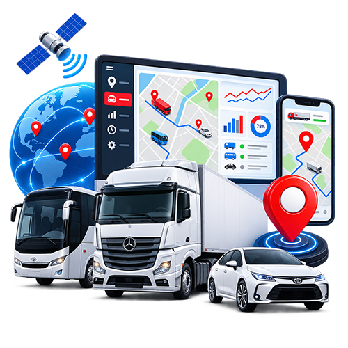
Modern GPS fleet management changes this completely. Instead of relying on estimates, organizations receive real-time information about every vehicle through a secure online platform. Managers can monitor vehicle locations, review completed trips, analyze driver behavior, receive instant alerts, and generate professional reports from a centralized dashboard. Consequently, NGOs gain complete visibility over their transportation operations while improving safety, reducing costs, and strengthening donor confidence.
For organizations operating across Kabul, Herat, Kandahar, Mazar-e-Sharif, Jalalabad, Kunduz, Bamyan, Badakhshan, and other provinces, GPS tracking provides continuous operational awareness regardless of where vehicles travel. Moreover, managers can monitor field activities remotely, allowing faster decision-making and better coordination between headquarters and field teams.
Another major advantage of GPS Tracking for NGOs in Afghanistan is transparency. Donors, project managers, and organizational leadership increasingly expect accurate information about how project resources are used. GPS tracking provides verifiable operational data that demonstrates responsible fleet management, improves accountability, and supports audit requirements.
This comprehensive guide explains everything NGOs need to know about GPS tracking in Afghanistan. Throughout this article, you will learn how modern GPS technology improves fleet security, reduces transportation costs, enhances driver safety, increases operational efficiency, and supports successful humanitarian operations across the country.
What Is NGO Fleet Management in Afghanistan?
GPS Tracking for NGOs in Afghanistan is the use of Global Positioning System (GPS) technology, cloud-based fleet management software, and intelligent reporting tools to monitor, manage, and optimize humanitarian vehicle fleets.
Unlike traditional vehicle supervision, GPS tracking provides continuous visibility into every vehicle operating within an organization’s fleet. Every movement, trip, stop, route, and location is automatically recorded and displayed on a secure web or mobile platform. Therefore, fleet managers no longer rely on manual updates or phone calls to understand what is happening in the field.
Modern GPS tracking systems collect operational information such as:
- Live vehicle location
- Vehicle speed
- Route history
- Engine status
- Driver behavior
- Idle time
- Geofence entry and exit
- Trip reports
- Working hours
- Maintenance reminders
- Fuel consumption (when equipped with sensors)
- Emergency alerts
Furthermore, organizations can monitor multiple projects, offices, and field teams from a single dashboard. Whether vehicles are supporting healthcare, education, disaster response, food distribution, infrastructure development, or emergency relief, managers receive accurate operational data in real time.
For NGOs operating in remote districts where direct supervision is difficult, GPS tracking significantly improves coordination between headquarters and field staff. As a result, project managers can verify that vehicles follow approved routes, reach project locations on schedule, and use organizational resources responsibly.
GPS tracking is not only a vehicle security tool, it is also a complete fleet management solution that helps humanitarian organizations improve efficiency, strengthen accountability, reduce operating costs, and deliver services more effectively.
Why NGOs in Afghanistan Need GPS Tracking
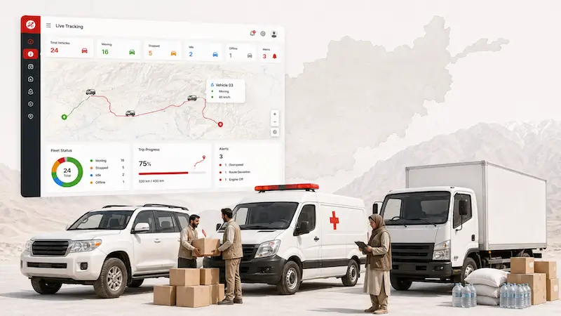
Humanitarian organizations operate in some of the most challenging environments in the world. In Afghanistan, NGOs regularly transport medical supplies, food, emergency relief items, educational materials, construction equipment, and field staff across cities, rural districts, and remote communities. Therefore, reliable transportation is essential for ensuring that humanitarian assistance reaches people on time.
Without modern fleet management technology, organizations often face delays, communication gaps, higher operating costs, and limited visibility into vehicle activities. As a result, project managers may struggle to coordinate field operations, verify vehicle movements, or respond quickly during emergencies.
GPS Tracking for NGOs in Afghanistan addresses these challenges by providing real-time visibility into every vehicle, improving operational efficiency, strengthening accountability, and enhancing the safety of both drivers and valuable humanitarian assets.
Supporting Humanitarian Operations Across Afghanistan
Many NGOs operate projects simultaneously in multiple provinces. Vehicles may travel daily between Kabul, Herat, Kandahar, Jalalabad, Mazar-e-Sharif, Kunduz, Bamyan, Badakhshan, Helmand, and remote villages.
Managing these vehicles manually is both time-consuming and inefficient.
With GPS tracking, project managers can:
- View every vehicle on a live digital map.
- Monitor project vehicles in real time.
- Verify that drivers follow approved routes.
- Coordinate field teams more efficiently.
- Respond quickly to unexpected situations.
- Improve communication between headquarters and field offices.
Consequently, organizations complete projects more efficiently while maintaining greater operational control.
Improving Emergency Response
Many humanitarian organizations provide emergency assistance during natural disasters, disease outbreaks, displacement crises, and urgent medical situations.
During emergencies, every minute matters.
GPS Tracking for NGOs in Afghanistan allows emergency coordinators to:
- Identify the nearest available vehicle.
- Dispatch emergency teams immediately.
- Monitor vehicle progress live.
- Estimate arrival times accurately.
- Redirect vehicles if road conditions change.
For example, if an ambulance or relief truck is required in a remote district, dispatchers can immediately locate the closest available vehicle instead of contacting multiple drivers individually. As a result, response times improve while critical supplies reach affected communities more quickly.
Increasing Fleet Security
NGO vehicles often transport valuable equipment, humanitarian supplies, medical products, and project materials.
Protecting these assets is essential.
GPS tracking improves vehicle security through features such as:
- Live location monitoring
- Geofencing
- Instant movement alerts
- Route deviation notifications
- Ignition status monitoring
- Trip history
- Vehicle recovery support
If a vehicle leaves an approved project area or operates outside working hours, managers receive immediate notifications. Therefore, organizations can respond quickly to unusual activities while reducing the risk of vehicle misuse or theft.
Key Benefits of NGO Fleet Management in Afghanistan
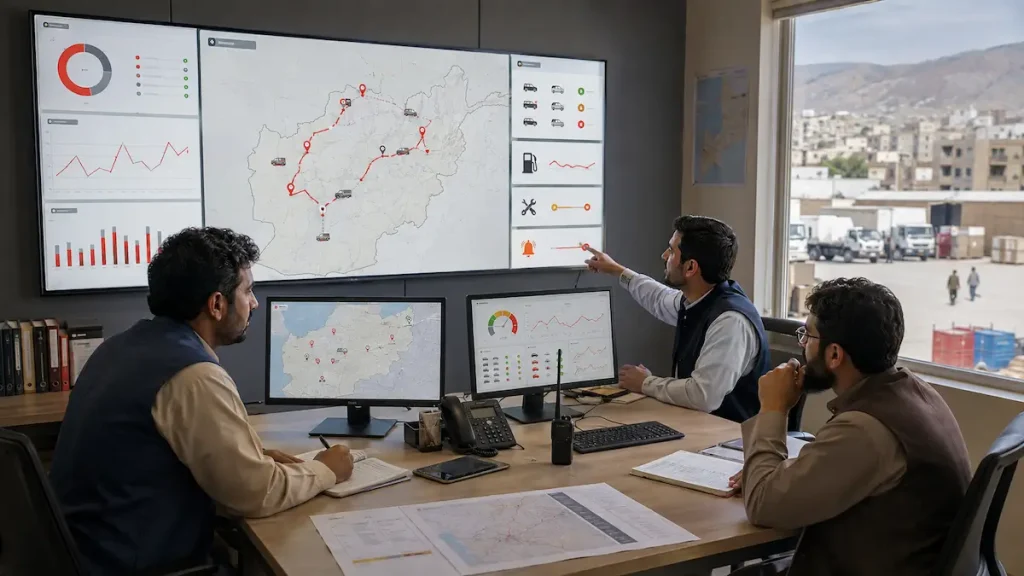
Implementing GPS Tracking for NGOs in Afghanistan provides measurable benefits that extend beyond simple vehicle tracking.
Complete Fleet Visibility
One of the greatest advantages of GPS tracking is complete operational visibility.
Instead of relying on phone calls or handwritten reports, managers receive live information about every vehicle from one centralized platform.
The dashboard displays:
- Vehicle location
- Driver status
- Current speed
- Ignition status
- Trip progress
- Route history
- Parking locations
- Working hours
Furthermore, project managers can monitor multiple provinces simultaneously, making nationwide fleet supervision much easier.
Better Resource Management
Vehicles are valuable organizational assets.
Using them efficiently helps NGOs maximize donor funding while improving project performance.
GPS tracking enables organizations to:
- Reduce unnecessary travel.
- Eliminate duplicate trips.
- Optimize daily schedules.
- Improve vehicle utilization.
- Reduce fuel consumption.
- Increase productivity.
Consequently, organizations accomplish more humanitarian work without increasing transportation costs.
Improving Driver Safety
Drivers frequently operate under difficult road conditions throughout Afghanistan.
GPS tracking improves driver safety by monitoring:
- Excessive speeding
- Harsh braking
- Rapid acceleration
- Long driving hours
- Dangerous driving behavior
- Route deviations
Managers can review driver scorecards and provide coaching when necessary.
Moreover, recognizing safe drivers encourages responsible driving habits while reducing accident risks.
Strengthening Donor Transparency
Transparency is one of the most important responsibilities of humanitarian organizations.
Donors expect project resources to be used efficiently and responsibly.
GPS tracking supports transparency by providing:
- Verified trip history
- Vehicle utilization reports
- Driver activity reports
- Route verification
- Daily operational summaries
- Fleet performance analytics
Instead of relying solely on manual reports, NGOs can provide objective operational data that demonstrates responsible management of donor-funded transportation resources.
Reducing Operating Costs
Transportation expenses consume a significant portion of many NGO budgets.
Fortunately, GPS tracking helps reduce costs by:
- Reducing unnecessary trips
- Optimizing travel routes
- Monitoring idle time
- Improving fuel efficiency
- Preventing unauthorized vehicle usage
- Supporting preventive maintenance
As a result, organizations spend less on transportation while allocating more resources to humanitarian programs.
Better Coordination Between Headquarters and Field Teams
Many humanitarian projects involve coordination between central offices, regional offices, and field staff.
GPS tracking creates a shared operational picture that improves communication throughout the organization.
Managers can instantly determine:
- Which vehicles are available
- Which teams are traveling
- Which projects are active
- Estimated arrival times
- Daily transportation progress
Consequently, decisions become faster, communication improves, and project activities remain well coordinated.
Real-World Example
Imagine an NGO operating 60 vehicles across Afghanistan to deliver healthcare supplies and emergency assistance.
Before implementing GPS tracking, project managers relied on phone calls, handwritten vehicle logs, and manual reporting.
This often resulted in:
- Delayed vehicle updates
- Difficulty verifying completed trips
- Limited fleet visibility
- Higher transportation costs
- Slow emergency coordination
After implementing Sahil Tracking’s GPS Fleet Management Platform, managers gained real-time visibility into every vehicle.
They could:
- Monitor live vehicle locations
- Verify project routes
- Improve dispatching
- Monitor driver behavior
- Generate professional reports
- Strengthen donor accountability
As a result, transportation became more efficient, project coordination improved, and operational transparency increased significantly.
Real-Time Vehicle Tracking for NGO Fleet Management in Afghanistan
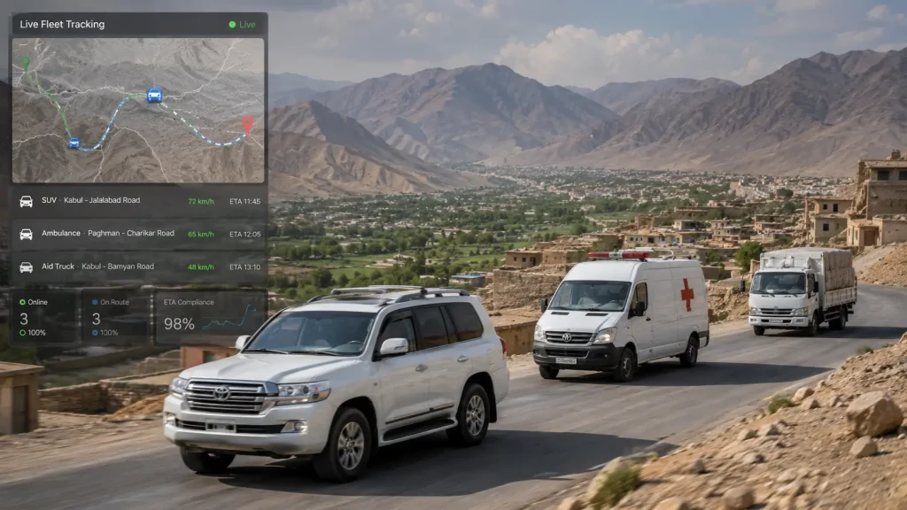
One of the most valuable features of GPS Tracking for NGOs in Afghanistan is real-time vehicle tracking. Humanitarian organizations often manage vehicles across multiple provinces, making it difficult to know the exact location of every fleet asset. However, with a modern GPS fleet management platform, managers can monitor every vehicle through a secure web or mobile dashboard, regardless of where it is operating.
Instead of contacting drivers by phone for location updates, project managers receive live information every few seconds. Consequently, decisions become faster, communication improves, and emergency responses become more effective.
Real-time vehicle tracking displays:
- Current vehicle location
- Speed
- Direction of travel
- Ignition status
- Driver information
- Trip progress
- Estimated arrival time
- Last communication time
Furthermore, managers can switch between different offices, projects, or provinces without leaving the dashboard, making nationwide fleet supervision much easier.
Better Coordination During Field Operations
Many NGOs operate several projects simultaneously, including healthcare, education, food distribution, disaster response, infrastructure development, and community support programs.
Without GPS tracking, coordinating dozens of vehicles across multiple locations becomes extremely difficult.
GPS Tracking for NGOs in Afghanistan allows project coordinators to:
- Assign the nearest available vehicle
- Monitor project progress live
- Verify completed field visits
- Track emergency response teams
- Improve communication with drivers
- Reduce unnecessary travel
As a result, organizations complete more field activities while using fewer transportation resources.
GPS Tracking for Medical and Ambulance Fleets
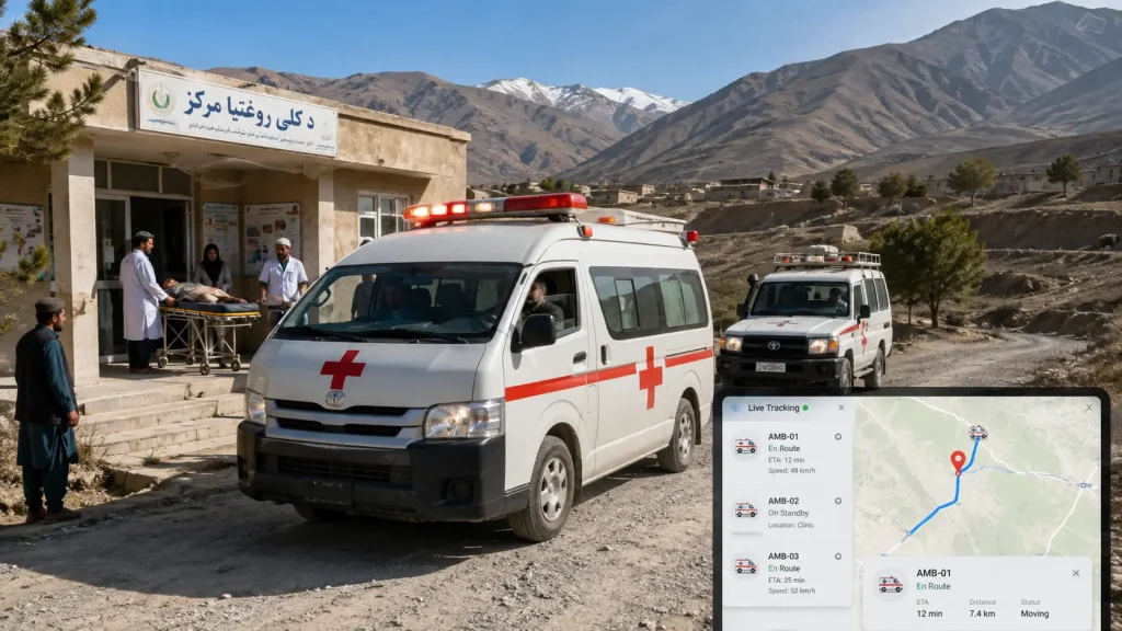
Healthcare organizations and humanitarian medical programs rely heavily on reliable transportation. Ambulances, vaccination teams, mobile clinics, and medicine delivery vehicles must arrive quickly and safely.
GPS tracking significantly improves medical fleet operations by providing continuous visibility into emergency vehicles.
Managers can:
- Locate the nearest ambulance instantly
- Monitor emergency response routes
- Track medicine deliveries
- Verify arrival times
- Reduce delays
- Improve patient support
Moreover, route optimization helps ambulances avoid unnecessary delays, ensuring patients receive medical assistance as quickly as possible.
GPS Tracking for Food Distribution Programs
Many NGOs deliver food assistance to vulnerable communities across Afghanistan.
These operations require careful planning because vehicles often travel long distances carrying valuable humanitarian supplies.
GPS tracking helps organizations:
- Monitor delivery vehicles in real time
- Verify delivery routes
- Reduce unauthorized stops
- Improve warehouse coordination
- Confirm successful deliveries
- Improve beneficiary service
Furthermore, managers can compare planned routes with actual routes, ensuring humanitarian supplies reach the intended communities efficiently.
GPS Tracking for Education Projects
Educational NGOs frequently transport teachers, learning materials, computers, furniture, books, and school supplies to project locations.
Managing these vehicles manually often results in delays and incomplete reporting.
GPS fleet management improves educational logistics by allowing organizations to:
- Monitor school supply deliveries
- Track project vehicles
- Improve transportation planning
- Reduce operating costs
- Coordinate regional offices
- Generate transportation reports
Consequently, educational resources arrive more efficiently while reducing administrative workload.
Geofencing for NGO Operations
Geofencing is one of the most powerful features available in modern GPS fleet management systems.
A geofence creates a virtual boundary around a project office, warehouse, hospital, construction site, refugee camp, or operational area.
Whenever a vehicle enters or leaves the designated area, the system automatically records the event.
Organizations can create geofences around:
- NGO headquarters
- Provincial offices
- Warehouses
- Project sites
- Medical centers
- Distribution points
- Vehicle parking areas
- Border crossings
Furthermore, managers receive instant notifications whenever vehicles leave approved areas outside working hours.
Consequently, geofencing improves fleet security while strengthening project accountability.
Maintenance Management for NGO Fleets
Vehicle reliability is essential for humanitarian operations.
Unexpected breakdowns delay projects, increase transportation costs, and reduce emergency response capability.
GPS fleet management simplifies maintenance by automatically tracking vehicle usage and scheduling service reminders.
Maintenance schedules may be based on:
- Mileage
- Engine hours
- Calendar dates
- Manufacturer recommendations
The platform reminds managers when vehicles require:
- Oil changes
- Tire replacement
- Brake inspections
- Battery checks
- Engine servicing
- Air filter replacement
Therefore, organizations prevent costly mechanical failures while extending vehicle lifespan.
Fuel Monitoring in NGO Fleet Management in Afghanistan
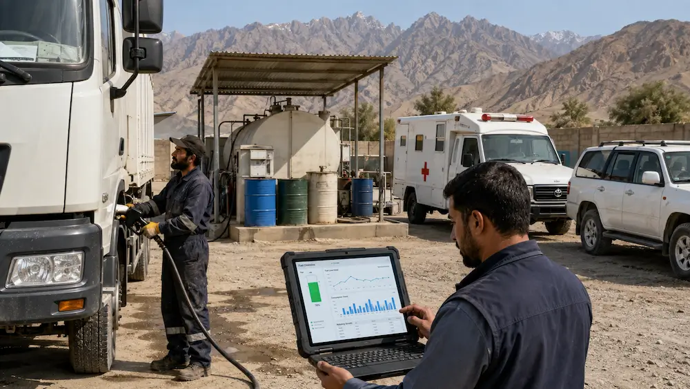
Transportation budgets are often one of the largest expenses for humanitarian organizations.
Therefore, reducing unnecessary fuel consumption directly increases the amount of funding available for community programs.
GPS fleet management combined with fuel monitoring helps NGOs:
- Monitor fuel consumption
- Detect unusual fuel loss
- Reduce engine idling
- Prevent unauthorized trips
- Improve driver efficiency
- Analyze fuel reports
- Compare vehicle performance
Furthermore, organizations equipped with electronic fuel sensors receive accurate information about fuel levels, refueling events, and sudden fuel changes that may indicate theft or leakage.
Consequently, managers can investigate unusual events immediately while improving financial transparency.
Increasing Donor Confidence Through GPS Tracking
Donors increasingly expect organizations to demonstrate responsible use of project resources.
GPS Tracking for NGOs in Afghanistan supports donor confidence by providing objective, verifiable fleet data.
Organizations can generate professional reports showing:
- Vehicle utilization
- Route history
- Project visits
- Driver activity
- Fuel consumption
- Working hours
- Maintenance history
- Emergency response performance
Instead of relying solely on manual records, NGOs can present accurate operational evidence during audits, donor reviews, and project evaluations.
As a result, organizations strengthen accountability, improve transparency, and build greater trust with funding partners.
Why Choose Sahil Tracking for NGOs in Afghanistan?
Selecting the right GPS fleet management provider is one of the most important decisions for any humanitarian organization. While many GPS tracking systems offer basic location monitoring, NGOs require much more than simply viewing vehicles on a map. They need a complete fleet management platform that improves security, increases accountability, reduces operational costs, and supports successful project delivery.
Sahil Tracking provides an advanced GPS fleet management solution designed to meet the operational needs of NGOs working throughout Afghanistan. Whether your organization manages emergency response vehicles, ambulances, food distribution trucks, staff transportation, or field support vehicles, our platform helps you monitor every journey with confidence.
Unlike basic tracking solutions, Sahil Tracking combines multiple technologies into one centralized platform, allowing organizations to improve efficiency while maintaining complete control over their fleet.
Comprehensive Fleet Visibility
Every vehicle can be monitored in real time through an intuitive web and mobile dashboard.
Managers can instantly view:
- Live vehicle locations
- Vehicle speed
- Driver activity
- Trip history
- Route playback
- Ignition status
- Parking duration
- Working hours
Consequently, project managers always know where vehicles are operating and can make informed decisions without contacting drivers repeatedly.
Enhanced Vehicle Security
Protecting humanitarian assets is essential for every NGO.
Sahil Tracking improves fleet security by providing:
- Real-time GPS tracking
- Geofencing alerts
- Route deviation notifications
- Unauthorized movement alerts
- Ignition monitoring
- Trip playback
- Vehicle recovery support
Furthermore, instant notifications help organizations respond quickly whenever unusual vehicle activity occurs.
Fuel Monitoring and Cost Control
Transportation costs represent a significant portion of most NGO budgets.
Sahil Tracking helps organizations reduce fuel expenses by monitoring:
- Fuel consumption
- Idle time
- Route efficiency
- Driver behavior
- Refueling events
- Fuel theft (with compatible sensors)
As a result, NGOs can allocate more project funding toward humanitarian programs instead of unnecessary transportation costs.
Intelligent Reporting
Reliable reporting is essential for project management and donor accountability.
The Sahil Tracking platform automatically generates reports including:
- Daily vehicle activity
- Trip history
- Driver performance
- Fuel consumption
- Vehicle utilization
- Idle time
- Maintenance reminders
- Overspeed events
- Geofence activity
- Fleet performance summaries
These reports support project monitoring, financial planning, internal audits, and donor reporting.
Local Support Across Afghanistan
Technology is only valuable when backed by reliable support.
Sahil Tracking provides:
- Professional device installation
- User training
- Technical support
- Platform configuration
- System updates
- Fleet management consultation
Our local team understands the transportation challenges faced by humanitarian organizations throughout Afghanistan and works closely with customers to ensure successful implementation.
Manual Fleet Management vs GPS Tracking for NGOs
| Manual Fleet Management | GPS Tracking with Sahil Tracking |
| Phone calls for vehicle updates | Real-time vehicle tracking |
| Paper logbooks | Automatic digital trip history |
| Manual fuel records | Fuel monitoring and analytics |
| Difficult route verification | Live route monitoring |
| Limited visibility | Complete fleet visibility |
| Manual maintenance scheduling | Automatic maintenance reminders |
| Delayed reporting | Instant dashboards and reports |
| Limited driver accountability | Driver behavior monitoring |
| Slow emergency coordination | Immediate vehicle dispatching |
| Higher operating costs | Improved operational efficiency |
Best Practices for NGOs Using GPS Tracking
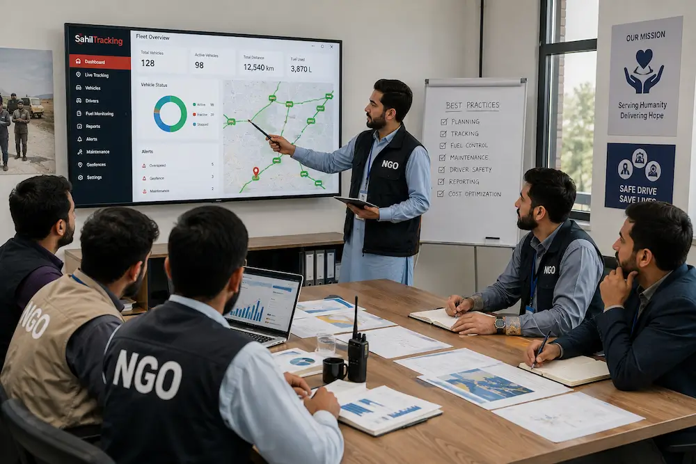
To maximize the benefits of GPS Tracking for NGOs in Afghanistan, organizations should follow these best practices:
1. Establish Clear Fleet Policies
Develop written policies covering:
- Approved working hours
- Authorized routes
- Vehicle usage
- Driver responsibilities
- Emergency procedures
Clearly defined policies improve accountability across the organization.
2. Review Fleet Reports Regularly
Managers should analyze:
- Daily trips
- Fuel consumption
- Driver performance
- Vehicle utilization
- Maintenance schedules
Regular reviews help identify opportunities for improvement.
3. Train Drivers
Drivers should receive training on:
- Safe driving
- Fuel-efficient driving
- Route compliance
- Emergency reporting
- Proper vehicle care
Well-trained drivers contribute to lower operating costs and improved safety.
4. Schedule Preventive Maintenance
Do not wait until vehicles break down.
Instead, use automated maintenance reminders to keep vehicles operating efficiently throughout the year.
5. Use Geofencing
Create virtual boundaries around:
- Offices
- Warehouses
- Project sites
- Hospitals
- Distribution centers
Managers receive instant alerts whenever vehicles enter or leave these areas.
Frequently Asked Questions
What is GPS Tracking for NGOs in Afghanistan?
GPS Trcking for NGOs in Afghanistan is a fleet management solution that enables humanitarian organizations to monitor vehicles in real time, improve security, optimize operations, and generate detailed reports.
Can GPS tracking improve donor transparency?
Yes. GPS tracking provides verifiable trip history, vehicle utilization reports, and operational data that support donor reporting and project accountability.
Is GPS tracking suitable for small NGOs?
Yes. Organizations with only a few vehicles can benefit from improved visibility, lower operating costs, and better vehicle security.
Can GPS tracking reduce fuel costs?
Yes. By monitoring routes, idle time, and driver behavior, organizations can significantly reduce unnecessary fuel consumption.
Can managers monitor vehicles remotely?
Yes. Authorized users can access live vehicle information through secure web and mobile applications.
Does GPS tracking improve driver safety?
Yes. Driver behavior reports help identify speeding, harsh braking, and other unsafe driving habits so organizations can provide additional training.
Is GPS tracking useful for emergency response?
Absolutely. GPS tracking allows dispatchers to locate the nearest available vehicle, improving response times during emergencies.
Can GPS tracking generate reports?
Yes. The platform provides detailed reports covering trips, routes, fuel consumption, driver performance, maintenance, and fleet utilization.
Contact Sahil Tracking
Looking for a reliable GPS tracking solution for your NGO?
Sahil Tracking provides professional GPS fleet management solutions designed for humanitarian organizations across Afghanistan.
Our platform includes:
- Real-time vehicle tracking
- Fleet management
- Fuel monitoring
- Driver behavior analysis
- Geofencing
- Maintenance management
- Professional reporting
- Web and mobile access
- Local technical support
Visit https://sahiltracking.com to learn more or request a free demonstration.